This February I am traveling to Vietnam and Cambodia and I want to take you with me, via my sketchbook. I have cooked up some fun ways to share with you (learn more here), but I am also planning to write a ten-part blog series about my ideas for keeping a travel sketchbook.
This is the first installation of the series, and it’s something that you can do from home, before you even leave. Draw a map! This can help you to get excited and plan for your trip. You could even do 5 minutes of prep and bring your materials and do this on the plane, if you have a long flight to your destination.
Wherever you are going, it is nice to have a map so that you can remember where you went. If you are traveling somewhere new this can also help you learn about where you are going: What countries, states, or provinces neighbor your destination? What are the major cities and how are they located compared to the places you are going? What are the major bodies of water? What about the geography; are there mountains, planes, or deserts? Think about what is interesting and important to you and what story you want to tell with your map.
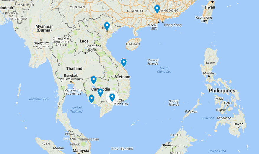
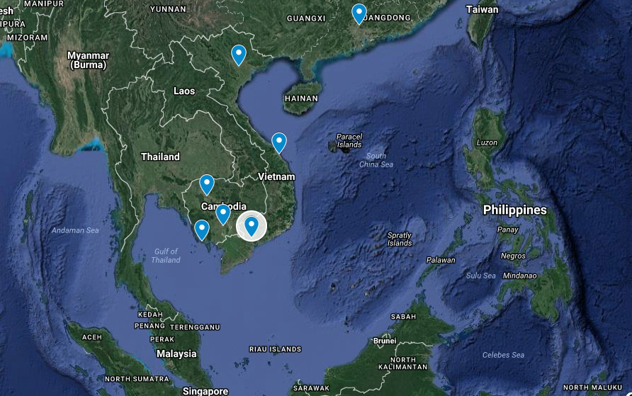
To do a bit of research I usually consult Google maps. You can go into My Maps in Google and create your own. In My Maps you can drop pins in the places you are planning to visit and choose different base maps to find a view that works for you. I like to use a combination of satellite imagery to show some geography and a simple map that shows the political boundaries.
Vietnam and Cambodia Map
I created this map for my sketchbook and colored it in with watercolor. I haven’t labeled the places yet because I’m not sure exactly where we are going. I plan to fill that information in as I travel. You can see that I highlighted Vietnam and Cambodia, the two countries I’ll be visiting. I also included some of the basic geography such as where the mountains are, and some of the rivers near where I am going.
For this blog entry I’m going to create a broader overview map of Southeast Asia, focusing around Indochina. Since it will an overview, I am not going to worry too much about getting detail in my drawings, but just draw out the general shape of the land and countries. I’ll roughly trace the map I created in Google maps, and add a few notes about countries and cities I want to include.
I like using tracing paper and a pencil, and then either doing a graphite transfer or use transfer paper to transfer my drawing onto watercolor paper. Do what works for you. Even free draw your map (without tracing) if it makes you happy. When tracing, remember you don’t need to create an exact replica, add or subtract detail where you want. You won’t be navigating from your (hopefully), it is just to collect information.
1
Make a sketch of your map using reference material
2
Plan out your transfer method to take your sketch to watercolor paper. (Here I use transfer paper)
3
Transfer to watercolor paper
I chose to color my map in with watercolor. Once it was transferred I painted in the oceans and seas with a phthalo blue wash. When that dried I painted in the land with warmer yellows, oranges, and reds. I didn’t worry too much about staying in the lines, but tried to differentiate the countries with different colors and shades. When everything was dry I went over the line work with pen and added labels.
4
Watercolor wash for water
5
Watercolor washes for the land
6
Go over painting with pen and add labels
You can be creative with your map. Before you start figure out how accurate you want to be and where you want to add detail to tell a story with your sketch. Remember you can be accurate and detailed in specific places you want to highlight.
I always learn a lot about whatever I am drawing, and doing this sketchbook page taught me a bit about Southeast Asian geography. I also got excited about traveling there. I hope it inspires you to make a map before your next trip! Stay tuned for more travel sketchbook tips as well as regular blog post installments.
Join my in my travels and get a copy of my travel sketchbook as well as other goodies...


